Save Big with New
All-inclusive Rate Plans

Connext®

Simplify the way you fly.

Scroll Down

What is Connext?

Connext is delivering the truly connected cockpit — one that seamlessly brings together people, flight information and portable devices in ways you’ve only imagined. From wirelessly uploading databases and flight plans from your iPad® to calling your spouse from 10,000' to let them know when you’ll be home, Connext promises to revolutionize your flying.

Cockpit Connectivity

Database Concierge

Spend more time flying and less time maintaining your databases. With Connext Database Concierge, you’ll streamline the update process for your navigation data, charts and more. Each database will automatically download to your portable device at home and then upload quickly to all your avionics when you get to the airport. It doesn’t get any easier and efficient.
Garmin Databases

For decades, customers have trusted Garmin with not only their avionics but with the data that helps them navigate. Garmin has a complete suite of data solutions — from our own Garmin Navigation Database to charts — to keep your avionics current with flexible and cost-effective prices. We offer a single annual price to update all of the databases available for a single Garmin navigator. Likewise, a OnePak database bundle provides all the database updates for all the Garmin avionics in your aircraft and a Garmin portable plus a Premium IFR Garmin Pilot subscription. Pair Garmin database services with Database Concierge for the most cost-effective and hassle-free database management experience available.

Flight Stream

The connected cockpit you’ve been dreaming of may be the one you already have.

With Flight Stream, you can add a wealth of information from your compatible avionics to select Garmin portables or mobile devices running the Garmin Pilot, ForeFlight Mobile or FltPlan Go apps. This includes critical flight information such as ADS-B traffic and weather, GPS position data, backup attitude information and more.

Better still, Flight Stream can also keep your flight plan in sync between your mobile device and navigator. So when ATC wants you to make an amendment, you can easily change it with a few touches to your compatible mobile app, and — in a snap — it’s updated to your navigator.

Automated Logbook

Garmin Pilot and our latest D2 series pilot watches already know everything about your flight, and now they can help update your logbook, too. As you take off, the logbook feature in either device can automatically open an entry and begin to record flight data, including date and time, day/night, aircraft type, duration of flight, departure and destination and more. When you land — and your tablet can access the internet — it’ll automatically upload the entry to flyGarmin.com®. You can later sign in to either flyGarmin.com or Garmin Pilot to add remarks, endorsements and more.

Remote

Keep your focus on flying with Connext remote control functionality. It allows your passengers to view and change SiriusXM® radio channels on their own, so you stay less distracted in flight. And with a Connext service plan, you can use Garmin Pilot to access the contacts in your phone, to send and receive text messages and initiate phone calls.

Connext also enables you to wirelessly control VIRB® action cameras. View what your remotely mounted camera is seeing, then start and stop recording as you desire, capture still photos, view elapsed time and more. This feature is currently available only with G3X Touch and Garmin Pilot.

Portables

Whether it’s a datalink that brings weather and traffic information from a nationwide ADS-B network or a localized Bluetooth®/Wi-Fi® connection between individual devices, wireless technology is revolutionizing how pilots use and connect with their portable devices in the cockpits.

For example, handy reminders and alerts from the Garmin Pilot app wirelessly appear on the D2™ series of pilot watches. You can also remotely control start/stop, view elapsed time and capture still shots on the VIRB series of action cameras using any of the D2 series of pilot watches or compatible tablet or mobile device.

Global Connectivity

Worldwide Weather

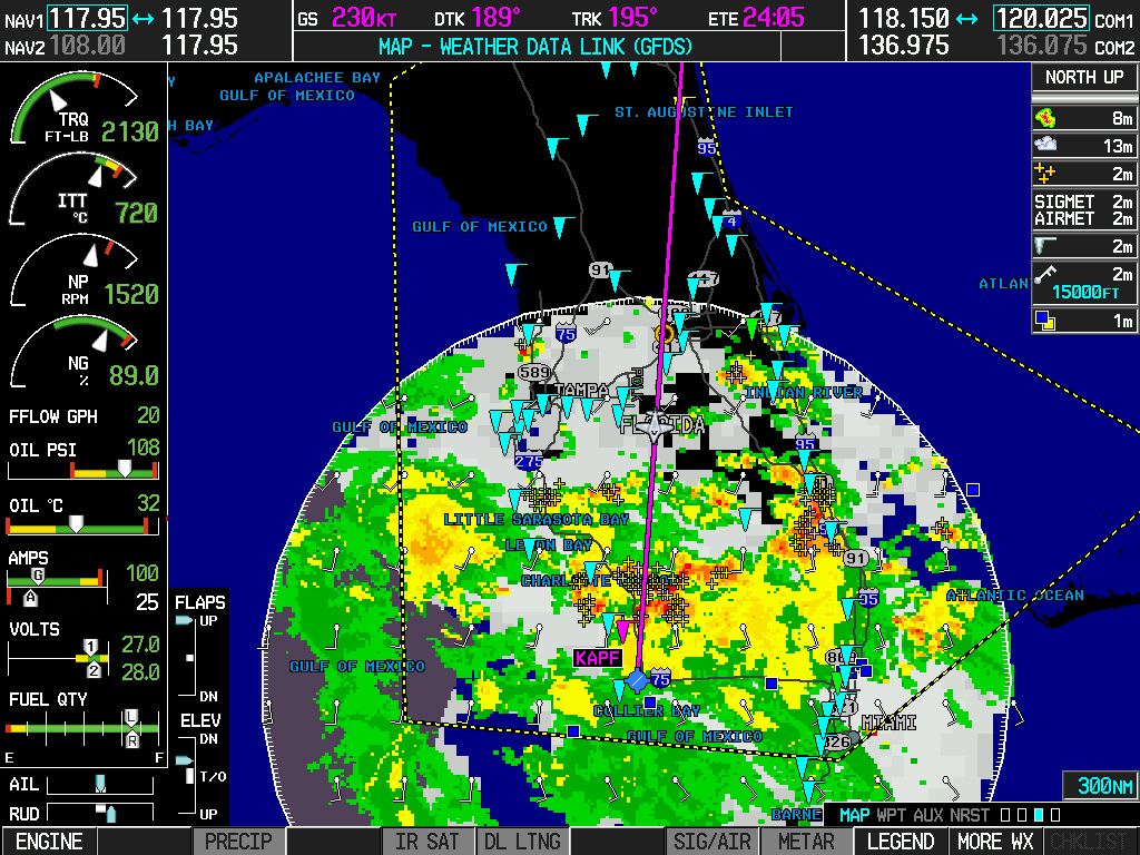
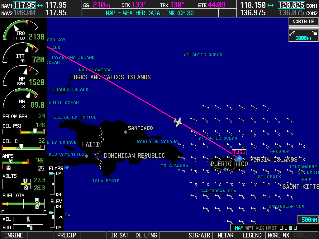
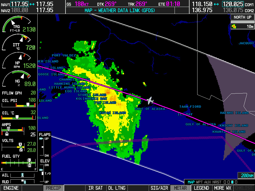
With Worldwide Weather through Connext, you can easily check weather conditions in virtually every corner of the globe. Worldwide Weather gives you access to NEXRAD radar, cloud cover, METARs, TAFs and much more for any point on the globe where the data is available. You can access this information right on your Garmin flight display from virtually anywhere in the world.

Click here to see more detailed weather information.

Choose a weather feature for more information.

Radar

High-resolution radar displays the precipitation you can anticipate on your route. Our returns are processed to remove most false returns and color coded to show the type of precipitation you can expect at ground level across the U.S., Canada, Australia and Western Europe.

Screen
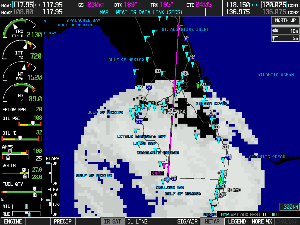
Satellite

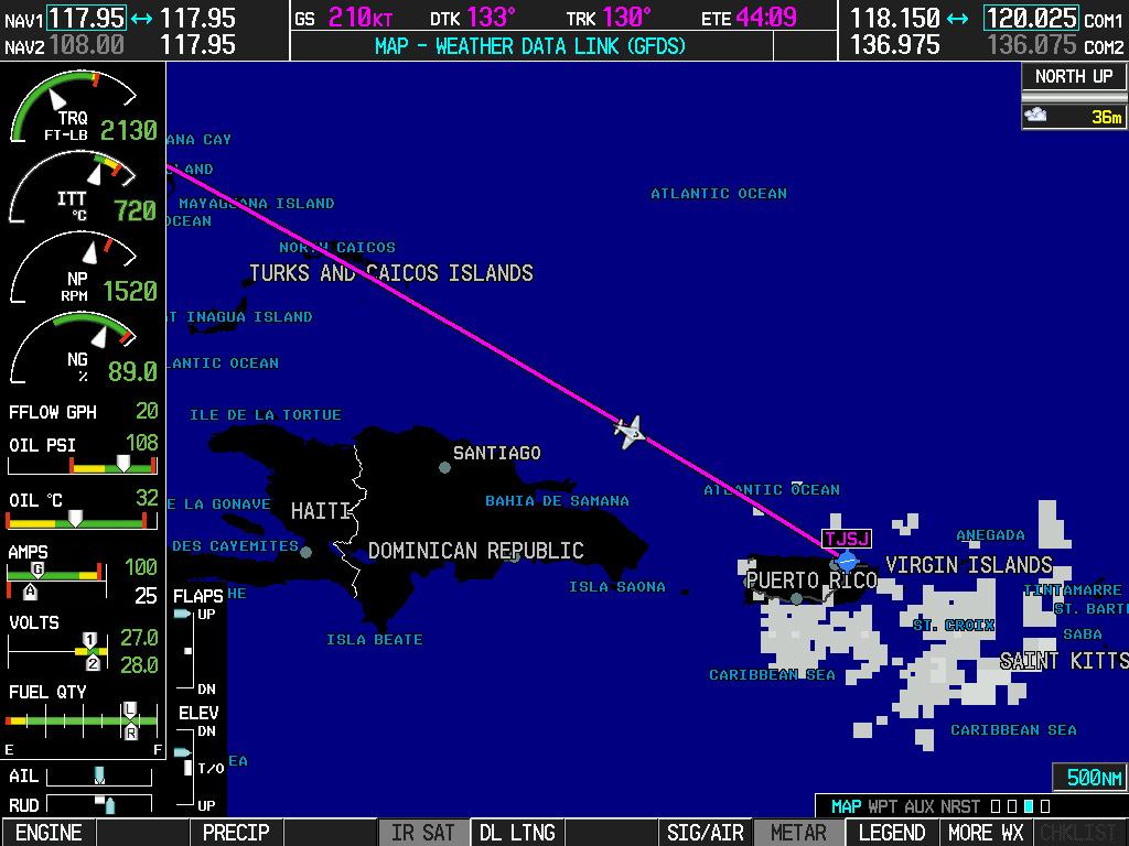
Discover how cloud cover may affect your flight with infrared satellite imagery. Darker grey clouds tend to be warmer and lower in the atmosphere while brighter shades indicate colder, taller cloud tops. Changes in temperature over time can give you an idea of whether a system is strengthening or weakening.

Screen
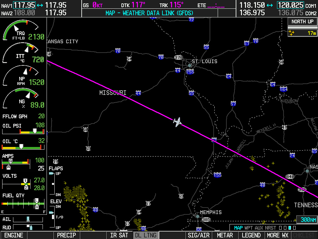
Lightning

Lightning maps can show you general areas with active lightning storms. When cloud-to-ground lightning strikes are detected, they’re plotted on the map.

Screen
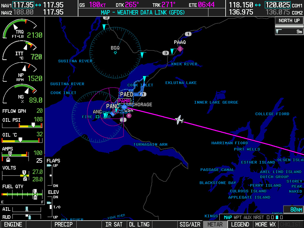
Metar

METARs are generally issued hourly and include routine weather observations generally collected form automated sources. METARs include temperature, dew point, visibility, cloud cover, ceiling height, precipitation, winds aloft and air pressure. SPECIs, or special reports, are also issued when conditions warrant.

Screen
Taf

Terminal Aerodrome Forecasts (TAFs) are generated for select airports by human forecasters. They usually include forecasts for visibility, ceilings and precipitation.

Screen
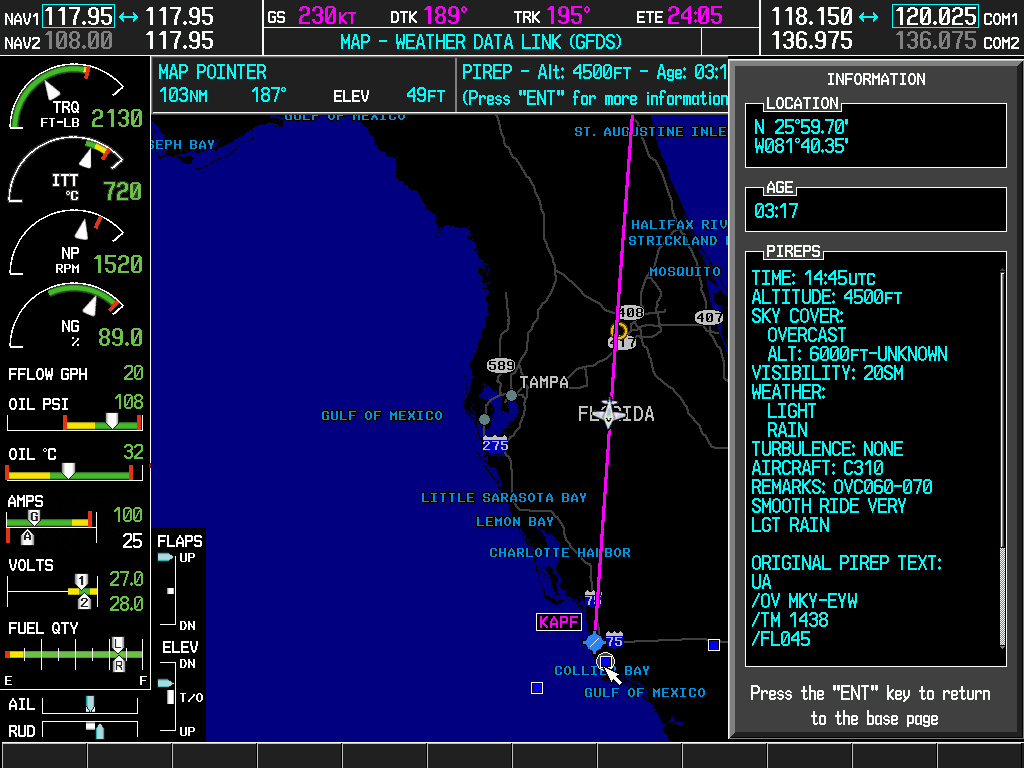
Pirep

Pilot Reports (PIREPs) include weather information observed and reported by pilots in flight. This can include cloud cover, ambient temperature, wind velocity and direction, turbulence, icing, visibility and more.

Screen
Sigmet/Airmet

SIGMETs, or Significant Meteorological Information, are advisories of significant meteorological information for aircraft. They may be issued for convection, icing, turbulence, IFR, mountain obscuration, volcanic ash and dust storms. AIRMETs, or Airmen’s Meteorological Information, are similar to SIGMETs, but cover less severe weather like moderate turbulence and icing, sustained winds or restricted visibility.

Screen
Winds Aloft

Winds Aloft provides the estimated speed and direction of winds based on computer model forecasts at various levels of the atmosphere.

Screen
Global Voice/Text Communication

Connext can keep your cockpit connected to those on the ground through the Connext satellite network. For example, text or call a business partner to let them know when you expect to land.

Position Reporting

Position reporting allows owners and operators to make better-informed business decisions while providing peace of mind about the safety of their aircraft and crews. For example, helicopter operators can schedule position information to be automatically sent to operations/ground crews during missions. Or fleet operators and flight schools can better track and manage their aircraft right from the hangar.

Duration: 41m 9s
Speed: 150kts
Altitude: 3500ft
Distance: 43nm
What is Next?

Connext is continually evolving to find new ways to simplify the life of a pilot. As new technologies evolve, new services will be added to the Connext lineup. So go ahead and imagine the possibilities — they may just become reality tomorrow.

Don’t Have Connext?

Browse our Connext-capable devices, and find the one that fits your needs.

Shop Now

Already have a Device?

Manage your Worldwide Weather, voice and text communications or position reporting through flyGarmin®.

Sign Up
Which product is right for you?
Flight Stream 110 Flight Stream 210 Flight Stream 510
Industry-leading GPS
ADS-B Weather/Traffic
SiriusXM Weather
SiriusXM Audio Remote Control
Attitude Information
Two-way Flight Plan Transfer
GTX 345, GDL® 88 and GDL 69/A Compatible
GSR 56 Compatible
GTN Series Compatible
GNS 430W/530W Compatible
Database Concierge
Voice and Text Control

¹Capabilities such as GPS, attitude, weather, traffic and flight plan transfer, SiriusXM weather and audio control are limited to the version of Flight Stream, the avionics installed in the aircraft as well as portable device. Compatibilities continue to grow with more Apps and Garmin portables. Check the ‘Supported Devices’ tab on the Flight Stream 110/210 page or the Flight Stream 510 page for the latest feature and compatibility information.

The Bluetooth® word mark and logos are registered trademarks owned by Bluetooth SIG, Inc. and any use of such marks by Garmin is under license.

Wi-Fi® is a registered trademark of the Wi-Fi Alliance.

iPad is a trademark of Apple Inc., registered in the U.S. and other countries.